 |
| Derryclare tea estate. Which is St. Clair falls can be seen from the Nuwera Eliya- Hatton Main road. It also can be seen from Train near St. Clair's railway station. |
 |
| St. Clair's Waterfall. Before Upper Kotmale reservoir was built. Photo taken on June 6, 2011 |
 |
| St. Clair's Waterfall. Before Upper Kotmale reservoir was built. Photo taken on June 6, 2011 |
 |
| St. Clair's Waterfall. Before Upper Kotmale reservoir was built. Photo taken on June 6, 2011. This photo won the Best photo of the week prize from www. tripping.com |
 |
| Upper Kotmale Dam . Photo was taken on March 1,2013. |
 |
| After Upper Kotmale Dam begun operation in 2012. Photo was taken on March 1,2013. |
 |
| Another view of St. Clair's falls, seen from Nuweral Eliya- Hatton road. After Upper Kotmale Dam begun operation in 2012. Photo was taken on March 1,2013. |
 |
| After Upper Kotmale Dam begun operation in 2012. Photo was taken on March 1,2013. |
 |
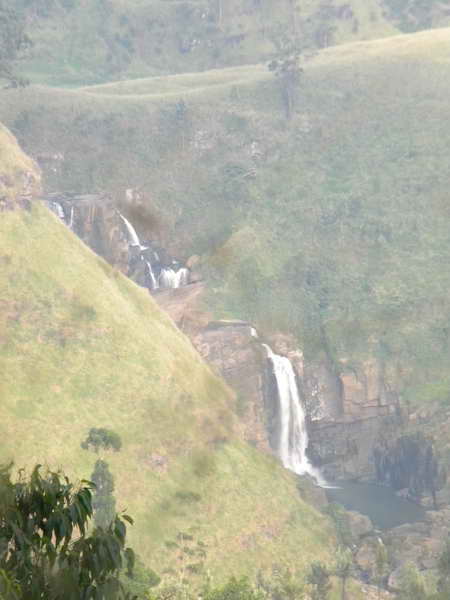
| St. Clair's - Lesser falls |
 |
| St. Clair's - Lesser falls |
 |
| St. Clair's - Lesser falls |
St. Clair's Falls is one the widest waterfalls in
Sri Lanka St. Clair's Falls is called the "Little Niagara of Sri Lanka"
, and it is one of the most politically discussed environmental entities in Sri Lanka
.
The Falls is 80m high and hence 20th highest waterfall in Sri Lanka. St.
Clair's falls comprises two falls called "Maha Ella" (Sinhalese "The
Greater Fall") and "Kuda Ella," (Sinhalese "The Lesser Fall") which is
50m high and was created by a tributary of Kotmale Oya.


No comments:
Post a Comment